Best Bike Trails for Beginners in Every State

Ready to ride? This guide defines what "beginner-friendly" means: confidence-building surfaces, manageable distances, and clear navigation so new riders can focus on the fun. We highlight paved multi-use paths, easy rail-trails, and low-stress singletrack across the united states.
Expect quick-scan usefulness. Jump to your region or state ideas, then pick a route by surface, miles, or the kind of scenery and views you want. Each suggestion is easy to customize—start with a short out-and-back, then extend as comfort grows.
What you’ll find: a mix of iconic long routes and local, practical paths that work well for first rides. Note that conditions change with weather, maintenance, or closures, so check current updates before you go.
Key Takeaways
- Beginner-friendly means easy surfaces, short distances, and simple navigation.
- Coverage includes paved paths, rail-trails, and gentle singletrack across the country.
- Choose by surface, miles, and the views you want to enjoy.
- Start short and extend rides as fitness improves.
- Mix of well-known routes and local favorites gives practical options nearby.
- Always verify trail conditions before heading out.
What Makes a Bike Trail Beginner-Friendly in the United States

Choosing the right route makes the first rides feel simple and fun. A clear surface, gentle climbs, and handy services help new riders build confidence fast.
Surface types that teach skills: paved paths like the Mount Vernon Trail and Tony Knowles Coastal Trail let riders practice balance and braking without loose gravel. Crushed limestone rail-trails such as the Katy Trail and Mickelson Trail offer a steady next step. Smooth singletrack at Sweetwater Preserve, Spruce Creek, or Paynes Creek introduces dirt riding with low technical stress.
Grades and access matter. Beginners do best on flat or gently rolling terrain. Look for routes with gradual descents or shuttle options in hillier regions. Good navigation — mile markers on Tony Knowles, 70+ access points along the Hudson River Greenway, or multiple parking spots at Tulsa River Parks — makes planning easier.
| Surface | Example | What it builds | Comfort notes |
|---|---|---|---|
| Paved path | Mount Vernon Trail | Braking, cornering, steady speed | Restrooms at many parking lots |
| Crushed limestone | Katy Trail | Stable off-pavement feel | Passes near towns for food and repairs |
| Smooth singletrack | Sweetwater Preserve | Basic dirt handling | Short loops, low technical features |
- Pick flat routes or short climbs to control effort.
- Use entrances with parking and clear signs so you can turn back easily.
- Carry water, plan rest stops, and pick trails near towns or parks for a backup.
- Follow shared-path etiquette: announce passes, keep predictable lines, and manage speed so other cyclists and riders feel safe.
Match the trail type to your goal — a fitness ride, a sightseeing path, or a gentle taste of singletrack — and you’ll enjoy the ride more. These options make it easy to progress without overwhelm.
Before You Ride: Simple Prep Tips for New Cyclists

Start smart with a few simple checks that keep your outing comfortable and safe. A brief pre-ride routine prevents small problems and keeps your focus on enjoying the path.
Comfort-first gear checklist
Helmet: a proper fit and replace about every five years.
Gloves & shorts: gel-cushion gloves reduce vibration; padded shorts with a quality chamois prevent chafing.
Lights & hydration: quick-release/rechargeable front and rear lights and an insulated water bottle if there's any chance you'll ride near dusk.
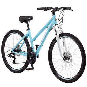
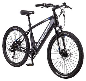
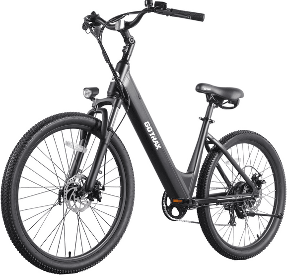
Picking the right bike for the route
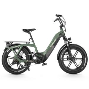
A hybrid works well on paved and crushed-limestone bike path routes. A mountain bike gives more control on dirt and beginner singletrack. Consider an e-bike to flatten hills and extend distance without extra strain.
| Surface | Suggested bike | Key setup |
|---|---|---|
| Paved | Hybrid | Comfort tires, saddle fit |
| Gravel/ballast | Hybrid or mountain bike | Wider tires, lower pressure |
| Singletrack | Mountain bike | Suspension, knobby tires |
Problem-solver kit: multi-tool, spare tube, tire levers, mini pump. Check tire pressure, brakes, and chain lube before you roll.
Plan extra time for breaks, photos, and learning the way—early rides are about confidence, not pace. Follow polite etiquette so all riders share the trail safely.
Best Bike Trails for Beginners in Every State
Find the right path by pairing your comfort level with route length and surface. Start with your state or travel destination, then filter choices by paved, gravel, or gentle singletrack. That makes planning fast and practical.
How to use this list
Pick your state, then match trail length and surface to what feels easy today. Choose a short out-and-back if you want a safe turn-around option.
Customize any ride
- Choose-your-comfort: 3–6 miles for first-timers, 8–15 miles for new-but-active riders, longer segments for aspiring trail tourists with clear bailout points.
- Use multiple entry points to shorten sections. Many routes have parking and restroom access every few miles.
- Prioritize fun: shade, services, and great views help new riders enjoy the first outing.
| Goal | Suggested miles | Quick tip |
|---|---|---|
| First ride | 3–6 | Out-and-back, pick flat path near town |
| Regular short ride | 8–15 | Loop or point-to-point with easy bailouts |
| Scenic sampling | Any | Ride short sections of long routes to enjoy views and scenery |
Use this guide to find route options that fit your day. With small sections and clear choices, riders and bikers can build confidence one pleasant ride at a time.
Beginner Bike Trails in the Northeast
The Northeast shines for gentle, service-rich routes that let new riders cover pleasant miles with little fuss. These paths combine smooth surfaces, easy navigation, and regular stops so first outings feel relaxed and fun.
Massachusetts — Minuteman Bikeway
The Minuteman Bikeway runs about 10 miles between Bedford and Alewife (Cambridge). It’s smooth, flat, and shaded.
Why riders like it: Revolutionary-era sites, frequent food stops, and easy turn-around points make it an ideal short route.
Rhode Island — East Bay Bike Path
This 14.5-mile paved route follows water and links parks and communities. The path offers steady miles and plenty of places to pause.
Tip: Plan breaks at waterfront parks to enjoy the views without feeling like you must stop riding permanently.
Vermont — Island Line Rail Trail
The Island Line Rail Trail gives about 13.4 miles of Lake Champlain frontage from Oakledge Park to South Hero.
Highlights include beaches at Leddy and North Beach, the Winooski River bridge viewpoint, the Colchester Causeway gravel section, and a seasonal bike ferry across the Cut. Rentals are available through Local Motion.
New York — Erie Canalway Trail
The Erie Canalway stretches some 360 miles of mixed paved and stone-dust surfaces. Pick short town-to-town segments for approachable rides.
Good to know: The railroad and canal history, plus small towns and bridges along the corridor, give scenic context without long commitments.
"Map the Northeast as a path-first region where beginners can rack up easy miles on protected corridors with lots of nearby services."
| State | Route | Length (miles) | Why it works for new riders |
|---|---|---|---|
| Massachusetts | Minuteman Bikeway | ~10 | Smooth pavement, flat, shaded, food stops |
| Rhode Island | East Bay Bike Path | 14.5 | Water views, parks, continuous paved path |
| Vermont | Island Line Rail Trail | 13.4 | Lakefront riding, beaches, causeway, rentals |
| New York | Erie Canalway Trail | 360 (entire) | Segmentable, canal history, town access |
Weekend planning note: Start early to avoid peak crowds near popular waterfront parks and urban access points. Short rides let you enjoy scenery and stop in small towns without rushing.
Beginner Bike Trails in the Mid-Atlantic
The Mid-Atlantic pairs wide, mostly flat corridors with big sights, so new riders can enjoy long river views without technical stress.
Mount Vernon Trail (Washington, DC — Virginia)
This paved route runs 18 miles along the Potomac. Park at Theodore Roosevelt Island, Gravelly Point, Belle Haven, or Mount Vernon.
Hours: 6 AM–10 PM. Portable restrooms appear at main lots. The Potomac-side views and monuments make the miles pass quickly.
C&O Canal Towpath (DC to Maryland)
The towpath is 184.5 miles of flat, segmentable river trail starting at Mile Marker 0 in Georgetown.
Follow key rules: 15 mph max, single file, yield to pedestrians and horses, helmets required. Use a hybrid or mountain bike on the rocky/gravel surface and test short sections before a full-day ride.
Hudson River Greenway (New York City)
This two-lane bike path covers about 12.9 miles with 70+ access points, parks, and skyline views.
Ride early mornings or weekdays for fewer people. Keep a steady, beginner-friendly pace and signal passes so other riders and pedestrians feel safe.
| Route | Length | Why it works |
|---|---|---|
| Mount Vernon Trail | 18 miles | Paved, scenic, many parking points |
| C&O Canal Towpath | 184.5 miles | Flat, segmentable, towns and services |
| Hudson River Greenway | 12.9 miles | Protected path, many access points |
Beginner Bike Trails in the Southeast
The Southeast offers quiet rail corridors, coastal causeways, and gentle singletrack that feel adventurous without being technical. Choose short sections or full out-and-backs to match how many miles you want that day.
Chief Ladiga Trail (AL/GA)
33 miles of smooth asphalt, minimal climbs, and family-friendly access. This route links to the Silver Comet for a continuous 94-mile corridor if you want more miles.
Boca Grande Rails to Trail (FL)
Paved, coastal path of roughly 6 miles on the island. Note a $6 causeway toll to enter and beach access at Gasparilla Island State Park. Bring water and sunscreen on exposed shore stretches.
Spruce Creek (FL)
Seven to ten miles of beginner-approved singletrack. Short loops let first-time dirt riders stop anytime and build confidence on flowing, low-tech lines.
Paynes Creek (GA)
Fast, smooth multi-loops near Lake Hartwell. Minimal climbing makes this a great place to practice cornering and braking on dirt.
Hilton Head Island (SC)
Over 117 miles of shared-use paths plus bike lanes and free maps. Rentals and kiosks make navigation easy, and many riders end their loop on the beach.
Virginia Creeper Trail (VA)
Total trail is 35 miles, but current repairs mean the Abingdon–Damascus section (~17 miles) is the recommended beginner segment. Check local updates; amenities may be limited during rebuilds.
Greenbrier River Trail (WV)
Seventy-eight miles of gravel/ballast with a gentle grade and quiet scenery. Ideal for riders who want low-pressure mileage through natural beauty.
| Route | Surface | Nearby notes |
|---|---|---|
| Chief Ladiga | Asphalt | Family-friendly, linkable to Silver Comet |
| Boca Grande Rails to Trail | Paved | Causeway fee, lighthouse, state park beach |
| Greenbrier River Trail | Gravel/ballast | Gentle grades, quiet scenery |
"Pick a short section, bring water, and enjoy low-stress riding among Southern scenery."
Beginner Bike Trails in the Midwest
Midwestern rail corridors make it easy to cover steady miles without steep climbs or tricky navigation.
Missouri — Katy Trail State Park
Katy Trail State Park runs about 237 miles of crushed-limestone surface along the Missouri River. The route follows the former Missouri-Kansas-Texas railroad, so grades stay gentle and navigation is straightforward.
Multiple access points and frequent small towns let you choose short sections or longer day rides. This state park is ideal when you want predictable effort and riverside scenery.
South Dakota — Mickelson Trail
The Mickelson Trail covers roughly 109 miles through the Black Hills on a crushed-limestone corridor. Expect 100+ railroad bridges, four tunnels, and sweeping views that make even modest miles feel rewarding.
Some segments are easy to moderate; pick flatter stretches near trail towns if you want an easier first outing.
How to plan Midwest rail trails
- Pick a trail town as your turnaround snack stop.
- Confirm parking at trailheads and carry extra water where services are spaced out.
- Choose flatter sections, avoid exposed windy stretches, and plan a conservative distance so the return feels easy.
| Route | Surface | Notes |
|---|---|---|
| Katy Trail State Park | Crushed limestone | 237 miles; many access points, flat |
| Mickelson Trail | Crushed limestone | 109 miles; bridges, tunnels, Black Hills views |
| Planning tips | — | Use towns, check parking, pick short sections |
Beginner Bike Trails in the Great Plains and Central States
City river corridors and connected park systems make excellent low-stress options for new riders. These routes blend smooth paving, short access points, and clear signage so a short outing feels rewarding.
Oklahoma — Tulsa River Parks Trail
Tulsa River Parks Trail stretches about 26 miles along the Arkansas River. The paved route links parks, parking, and restrooms, and includes lighting that supports evening rides while reminding riders to keep visibility gear on.
The trail intersects Gathering Place and Turkey Mountain Urban Wilderness Area. It also crosses historic Route 66 near 11th Street, giving easy detours to viewpoints and snack stops.
How to pick an easy route near towns
City-based paths are a beginner secret weapon: smooth surfaces, frequent exits, and many reset points if you tire or weather changes.
- Start at a major park (Gathering Place) for restrooms, water, and clear parking.
- Choose short out-and-back miles so you can turn around anytime.
- Look for protected crossings, park connections, and clear signage to keep navigation stress-free.
- Use nearby attractions—viewpoints, cafes, or playgrounds—to make the ride feel purposeful and fun.
| Feature | Why it helps | How to use it |
|---|---|---|
| Paved surface | Smooth, predictable riding | Practice balance and steady speed on short segments |
| Multiple access points | Flexible turn-around options | Plan 2–6 mile loops from a single lot |
| Lighting | Expanded riding windows | Use lights and reflective gear for early evenings |
Ride tip: Keep speeds comfortable on busy shared paths and choose quieter times if you’re nervous around faster riders and bikers. Short, pleasant outings build confidence quickly.
Beginner Bike Trails in the Mountain West
Mountain corridors often feel larger than their mileage, so plan short outings and soak up the views.
Summit County Recreational Pathway (CO) is a ~55-mile network with a famous 12-mile paved descent from Vail Pass to Frisco. Use the shuttle from Frisco to Vail Pass and enjoy a mostly downhill, low-stress ride with big mountain views and wildflower or aspen color in season.
Dawson’s Butte & Ridgeline Open Space (CO) offer approachable Front Range singletrack. Grades are friendly, loops are short, and other riders make lines feel welcoming for first dirt sessions.
Park City, Utah has 450+ miles of trails with green routes aimed at families and new mountain bikers. Watch elevation and weather; high-altitude riding can feel harder than the miles suggest.
Skip Moab’s slickrock at first. Its technical, high-traction terrain is better after you gain confidence on gentler singletrack.
| Route | Why it works | Notes |
|---|---|---|
| Summit County Pathway | Paved descent, shuttle-friendly | 12-mile Frisco run; towns for food |
| Dawson’s Butte / Ridgeline | Easy singletrack loops | Front Range access, beginner-friendly |
| Park City green trails | Family-oriented, many green routes | High elevation; monitor weather |
Quick tips: Start conservatively, carry water, and walk a short feature if needed. Turning back or walking is a normal way to build skill and confidence on mountain terrain.
Beginner Bike Trails in the Southwest Desert States
Desert rides teach careful pacing: even short loops can feel long under the sun. Traction shifts, heat, and bright light make planning critical.
Sweetwater Preserve (Arizona) offers about 8 miles of beginner-grade singletrack near Tucson. The network is generally smooth and framed by Saguaro cactus, making the scenery a big draw without heavy technical demands.
How to handle rocky sections
If you can’t see a clean line at your current speed, slow down or walk a few feet. That simple rule keeps progress steady and reduces crashes.
Pre-ride tricky features: stop, look, decide, then ride or walk. Repeat a short loop to build confidence, practice braking before turns, and stop while you still feel good so the next session stays fun.
Desert safety notes: carry extra water, ride early to avoid peak heat, and use sun protection. For added options, consider a mountain bike or mild mountain biking routes if you want more cushion on rocky terrain.
"Short desert loops reward steady skills and great views when you plan for sun and traction."
| Feature | Why it helps | How to use |
|---|---|---|
| Short loop | Manages effort | Repeat for skill building |
| Pre-ride inspection | Safer choices | Stop, look, decide |
| Extra water | Heat management | Carry one more bottle than usual |
Beginner Bike Trails on the West Coast
From coastal singletrack to city riverside paths, the West Coast offers clear options for short, confidence-building rides.
Fort Ord, California
Fort Ord is popular for low-technical singletrack. Most lines are smooth, but climbs can be physically demanding. Choose short loops, rest often, and treat steep sections as fitness work rather than tech practice.
Los Gatos Creek Trail, California
This ~10-mile multi-use path is an easy local option. The path is well marked, flat in many stretches, and ideal for short out-and-back rides with flexible turnaround points.
Banks-Vernonia State Trail, Oregon
The 21-mile asphalt rail trail keeps grades steady. Restored railroad bridges and mixed forest and farmland scenery make the ride pleasant and predictable from spring through fall.
Burke-Gilman Trail, Washington
The 27-mile paved corridor runs through suburbs and parks with frequent access to shops and services. That convenience reduces stress for riders who want quick water, snacks, or minor repairs.
- Choose your style: singletrack for short challenges or paved paths for easy mileage.
- Shared-path tip: ride predictably, pass carefully, and pick off-peak times for a calmer first outing.
| Route | Surface | Why it works |
|---|---|---|
| Fort Ord | Singletrack | Low-tech lines; climbs are physical |
| Banks-Vernonia | Asphalt rail trail | Consistent grades; scenic bridges |
| Burke-Gilman / Los Gatos | Paved paths | Urban services; flexible turnarounds |
Beginner Bike Trails in Alaska and the Far North
Alaska surprises many riders with long, smooth paved corridors that showcase towering peaks and shoreline wildlife.
Tony Knowles Coastal Trail is a 22-mile round trip (11 miles each way) in Anchorage. The path stays mostly flat with a few short climbs. It delivers striking views of the Chugach and Talkeetna Mountains and, on clear days, Denali and Cook Inlet.
How to plan the ride
Treat the route as an out-and-back and use mile markers to set safe turnaround goals. Budget 2–4 hours if you plan photos and wildlife stops.
Stops and milestones
Key breakpoints: Earthquake Park for an interpretive pause and Kincaid Park for restrooms, parking, and picnic areas. Point Woronzof is good for birdwatching and short sightlines.
Cold-weather and wildlife basics
Layer up: bring wind protection near the water and keep hands warm so braking and shifting remain safe.
Wildlife etiquette: stay alert, slow down when sightlines are limited, and never crowd moose, bears, or shore animals. If an animal blocks the path, give space and consider turning back until it moves away.
Timing tip: pick daylight windows and calmer weather so the ride feels relaxed. Morning or late-afternoon light often improves scenery and wildlife viewing.
| Feature | Detail | Why it helps | Practical tip |
|---|---|---|---|
| Length | 22 miles round trip | Segmentable for short outings | Use mile markers to set turnaround |
| Scenery | Mountains, inlet, wildlife | High reward, low technical demand | Bring camera and binoculars |
| Facilities | Kincaid Park restrooms, porta-potties | Comfort stops on long days | Plan breaks every 4–6 miles |
When to Go and How Long to Ride: Planning Your First Bike Trail Trip
Good timing and a clear plan make a short trip feel like a win. Pick the season and distance to match energy, weather, and what you want to see. A little prep keeps the focus on scenery and fun.
Seasonal sweet spots
Spring brings wildflowers and comfortable temps on many routes. It’s a great time to enjoy color without intense heat.
Summer opens high-elevation access in Colorado and Utah, ideal for cooler air and wide views. Fall delivers crisp days and vivid foliage on eastern paths.
Optional winter note: northern areas can offer fat‑tire options for riders who like snowtime adventures.
Trail services that matter
Restrooms, water, and bike rentals reduce stress and lower the barrier to a good ride. Examples: Local Motion rents bikes on Island Line; Mount Vernon has portable restrooms at many lots; Burke‑Gilman and the C&O have repair shops and town services nearby.
Why it helps: easy access to repairs and food turns small issues into minor delays, not ruined plans.
How long should my first ride be?
- Pick 3–6 miles for an easy first trip; 6–12 miles if you’re moderately active.
- Factor heat, elevation, and crowds—adjust miles down on hot or busy days.
- Plan a clear turnaround time so you finish feeling strong.
| Element | Why it matters | Example |
|---|---|---|
| Restrooms | Reduce stress on longer outings | Mount Vernon portable units |
| Rentals | Lower cost and packing needs | Local Motion (Island Line) |
| Repairs & towns | Save a day if mechanical issues occur | C&O Canal corridor towns |
Plan A / Plan B: pick a primary route and a shorter nearby option in case weather, fatigue, or crowds force a change. Check closures, trail rules (yielding, speed limits), and parking hours before you leave.
"Choose trail towns or park hubs with food and shade so breaks feel like part of the trip, not an emergency."
Pre-ride checklist: verify current closures, confirm parking and trailhead hours, pack water and basic tools, and note where rentals and repair shops are located.
Conclusion
Conclusion
Wrap up your ride plan with one clear rule: pick a route that fits how you feel today. A flat bike path by the water or a smooth trail loop with walkable features can both make a great first outing.
Start small and repeat often. A few easy miles build confidence faster than one long, tiring trip. Across regions you’ll find rewarding views, local history, and even old bridges that make short rides feel memorable along the way.
Customize each outing: choose short sections, ride out-and-back, and use towns or parks as rest points along the way. Pick one nearby trail, pack comfort-first gear, set a clear turnaround, and enjoy the ride. When that feels easy, add miles, try a new surface, or move from paved to crushed limestone and then to smooth singletrack.
FAQ
What makes a trail beginner-friendly?
How do I pick the right bike for a given trail?
What basic gear should I bring on a first ride?
How long should my first ride be?
Are rail-trails better for new riders than singletrack?
How do I handle hills as a beginner?
What safety tips should I follow on multi-use paths?
How can I find family-friendly routes near me?
When is the best season to ride different regions?
How do I plan longer rail-trail trips with services along the way?
What should I know about wildlife and weather in northern and remote areas?
Are e-bikes allowed on all beginner routes?
How do I approach short technical features on easy singletrack?
Where can I rent bikes and find beginner group rides?